-40%
The Republic of Texas as Recognized by the US
$ 179.25
- Description
- Size Guide
Description
The original sale price is 5plus tax on the website below.https://galleryoftherepublic.com/product/the-republic-of-texas-as-recognized-by-the-united-states/
Description
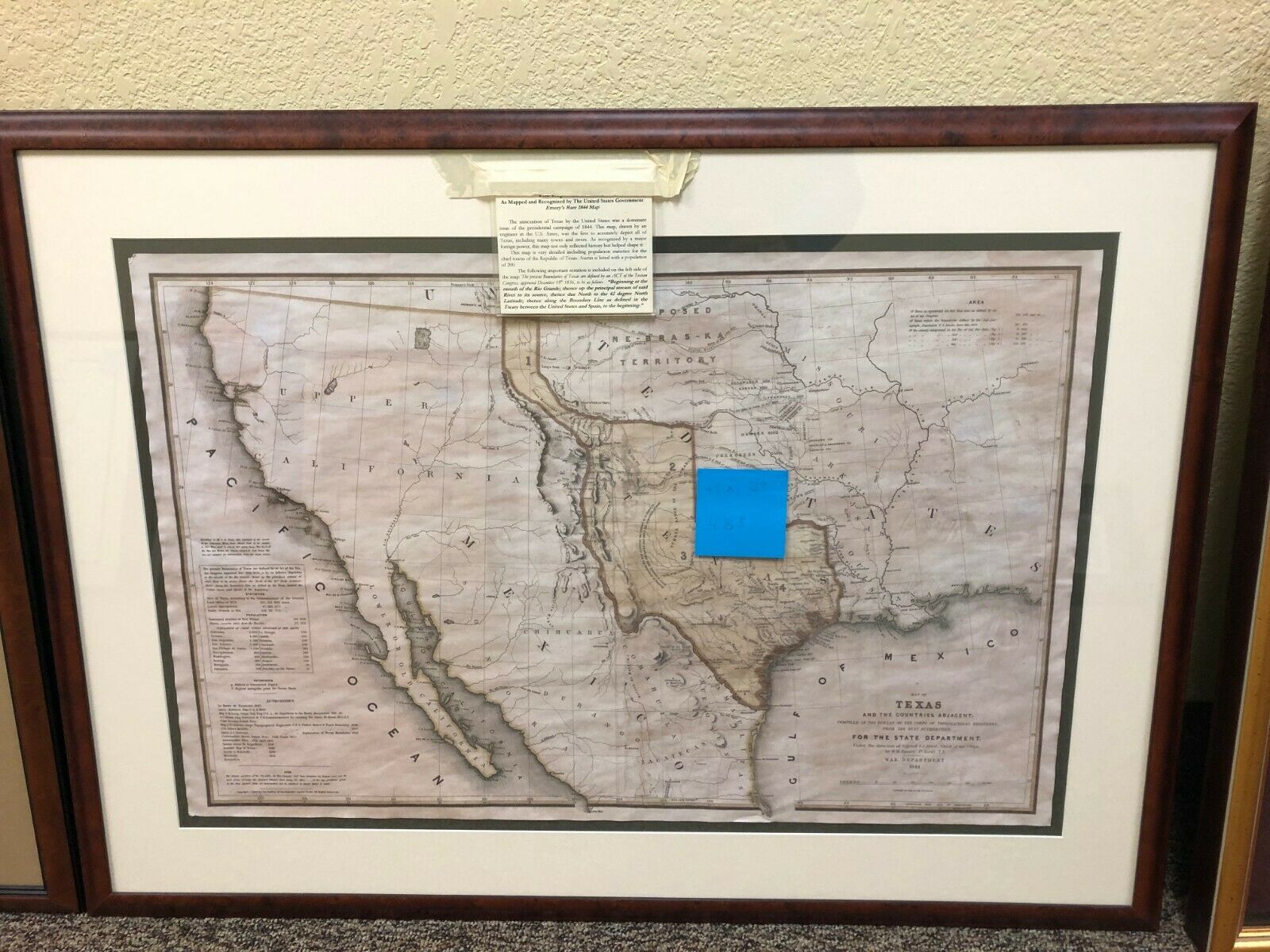
The annexation of Texas by the United States was a dominant issue of the presidential campaign of 1844. This map, drawn by an engineer in the U.S. Army, was the first to accurately depict all of Texas, including many towns and rivers. As recognized by a major foreign power, this map not only reflected history but helped shape it.
This map is very detailed including population statistics for the chief towns of the Republic of Texas. Austin is listed with a population of 200.
The following important notation is included on the left side of the map: The present Boundaries of Texas are defined by an ACT of the Texian Congress, approved December 19th 1836, to be as follows – “Beginning at the mouth of the Rio Grande; thence up the principal stream of said River to its source, thence due North to the 42 degree North Latitude; thence along the Boundary Line as defined in the Treaty between the United States and Spain, to the beginning.”
